GeoLens
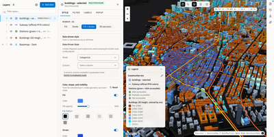
Transforming scattered spatial files into an interactive data catalog, GeoLens empowers engineering and GIS teams to organize geospatial assets, execute semantic searches, and build interactive 3D maps on self-hosted infrastructure. Users can ingest shapefiles, GeoJSON boundaries, database tables, and Cloud-Optimized GeoTIFF rasters into a centralized inventory with automatic source freshness auditing. Natural language queries evaluate dataset relevance across spatial boundaries and thematic tags, allowing analysts to uncover hydrology networks or zoning footprints without knowing exact layer names. The browser-based composition canvas lets cartographers extrude three-dimensional building footprints, overlay elevation terrain contours, color features by attribute values, and reorder layer hierarchies with drag-and-drop ease. Finished map projects publish immediately as secure shareable web links or responsive embeds for external dashboards. Desktop GIS operators can connect directly from QGIS or ArcGIS through native OGC API Features and STAC endpoints to query live vector tiles and run spatial filters. Teams can export filtered geometries into GeoPackage, FlatGeobuf, GeoParquet, or PMTiles archives to support downstream analysis workflows. Running on a dedicated VPS on RepoCloud with guaranteed CPU, RAM, and SSD, full root SSH access, and a browser serial console. Apache 2.0 licensed.
TRIP
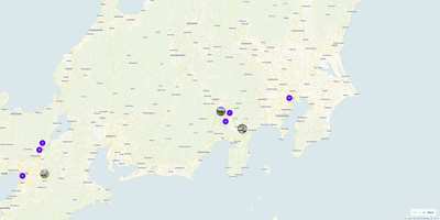
Plan multi-day expeditions, map custom waypoints, and coordinate shared group travel itineraries with TRIP, a private self-hosted journey management platform free from commercial tracking. Travelers can drop custom pins across global topographic or satellite maps, tagging locations with categories, visit durations, cost estimates, accessibility notes, and pet-friendly attributes. The visual trip builder organizes individual stops into ordered daily schedules, helping you calculate travel intervals and rearrange destination sequences using intuitive drag-and-drop tools. You can attach reference photos, booking confirmations, external links, and packing checklists directly to each itinerary milestone. Shared workspace controls enable travel companions to collaborate on upcoming road trips, leave comments on specific attractions, and coordinate shared responsibilities in real time. Dynamic filtering lets you isolate culinary destinations, outdoor hikes, or cultural landmarks by budget and travel style. Offline caching ensures your navigational routes and saved coordinates remain accessible in remote backcountry areas with spotty cellular coverage. Running on a dedicated VPS on RepoCloud with guaranteed CPU, RAM, and SSD, full root SSH access, and a browser serial console. MIT licensed.