Project NOMAD
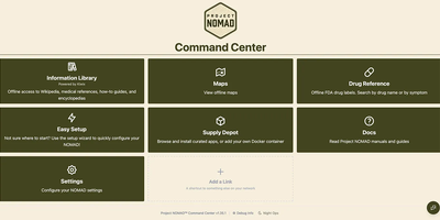
When the connection drops, Project NOMAD keeps serving offline Wikipedia, Khan Academy courses, maps, and an optional private AI assistant from a single Debian-based Linux server. The core needs only about 5 GB of disk and under 1 GB of RAM. Content is what fills the drive, and a setup wizard sorts it into Essential, Standard, and Comprehensive tiers while a storage bar tracks the running total. Wikipedia runs from a quick-reference set of the top 100,000 articles to the complete English edition with images at about 121 GB, and Kiwix also serves medical references, survival and repair guides, and Project Gutenberg ebooks. Kolibri adds Khan Academy courses with multi-user progress tracking, and any browser on the network can study. Offline maps cover the whole globe, single countries, or regions, with markers you can search, color, and navigate to by coordinate. The AI assistant is the heavy part, bringing the install to roughly 25 GB. It chats through Ollama or any OpenAI-compatible server such as LM Studio, searches uploaded documents, lists sources with dates when known, and lets vision models read attached images. CyberChef handles encoding and hashing, and FlatNotes keeps Markdown notes. The Supply Depot adds one-click apps or your own Docker containers. Opt-in auto-updates for the Command Center, installed apps, and downloaded content run inside a window you set. Running on a dedicated VPS on RepoCloud with guaranteed CPU, RAM, and SSD, full root SSH access, and a browser serial console. Apache 2.0 licensed.
Dawarich
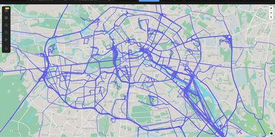
With over 9,000 GitHub stars earned since Google killed its browser-based Timeline, Dawarich fills the gap with a fully self-hosted location history platform that keeps your movement data under your control. Built on Ruby on Rails 8.0 with PostgreSQL and the PostGIS spatial extension for geometry-based queries, Dawarich imports your entire Google Takeout location archive in minutes and begins rendering interactive maps immediately. The visualization engine supports five map layers — heatmaps, points, lines, Fog of War exploration tracking, and a 3D globe view — each powered by Leaflet and spatial SQL rather than browser-side computation. Native iOS and Android apps handle background GPS tracking with offline support, automatically uploading location points when connectivity returns, while third-party integrations support OwnTracks, GPSLogger, Overland, Home Assistant, Traccar, and PhoneTrack. The trip system lets you create route visualizations between any two dates, attach notes, replay travel paths with a timeline scrubber, and share trips publicly with phrase-protected links and per-section visibility controls. Immich and PhotoPrism integrations automatically overlay geotagged photos on your maps and trips, while AirTrail integration renders flight history as arcs. Statistics dashboards break down countries visited, cities explored, total distance traveled, and active days by year and month, with visit detection suggesting places you have frequented. Running on a dedicated VPS on RepoCloud with guaranteed CPU, RAM, and SSD, full root SSH access, and a browser serial console. AGPL-3.0 licensed.