Wanderer
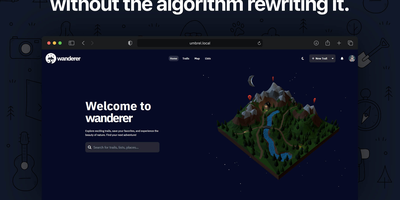
Wanderer provides a privacy-first alternative to AllTrails and Komoot, giving outdoor enthusiasts complete ownership of their GPS data on a self-hosted server. The platform accepts uploads in GPX, KML, FIT, and TCX formats, automatically extracting distance, elevation gain and loss, duration, and speed statistics to build a searchable trail catalogue. The built-in route planner uses the Valhalla routing engine to calculate hiking, cycling, and walking routes directly on the map, while MapLibre GL renders smooth vector tiles from OpenStreetMap data with configurable tile sources and overlay layers. Each trail supports rich metadata including difficulty ratings, categories, waypoints with descriptions, photo galleries, and summit log entries that track completion dates with optional GPS data. Meilisearch powers instant full-text search across trail names, descriptions, and tags, complemented by map-based spatial filtering and advanced date, distance, and elevation filters. The ActivityPub integration follows the same federation protocol as Mastodon, allowing users to follow explorers on other Wanderer instances and see their public trails, comments, and summit logs in a unified feed without requiring cross-instance accounts. The WASM-based plugin system enables third-party extensions for custom integrations. The Docker Compose stack runs three containers — SvelteKit frontend on port 3000, PocketBase backend with embedded SQLite, and Meilisearch — with startup completing in under 90 seconds. On RepoCloud, deploy Wanderer on a dedicated VPS with root SSH access, persistent storage for your trail database and uploaded photos, and complete control over routing, geocoding, and tile server configurations, all under the AGPL v3 license.
Dawarich
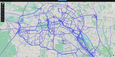
With over 9,000 GitHub stars earned since Google killed its browser-based Timeline, Dawarich fills the gap with a fully self-hosted location history platform that keeps your movement data under your control. Built on Ruby on Rails 8.0 with PostgreSQL and the PostGIS spatial extension for geometry-based queries, Dawarich imports your entire Google Takeout location archive in minutes and begins rendering interactive maps immediately. The visualization engine supports five map layers — heatmaps, points, lines, Fog of War exploration tracking, and a 3D globe view — each powered by Leaflet and spatial SQL rather than browser-side computation. Native iOS and Android apps handle background GPS tracking with offline support, automatically uploading location points when connectivity returns, while third-party integrations support OwnTracks, GPSLogger, Overland, Home Assistant, Traccar, and PhoneTrack. The trip system lets you create route visualizations between any two dates, attach notes, replay travel paths with a timeline scrubber, and share trips publicly with phrase-protected links and per-section visibility controls. Immich and PhotoPrism integrations automatically overlay geotagged photos on your maps and trips, while AirTrail integration renders flight history as arcs. Statistics dashboards break down countries visited, cities explored, total distance traveled, and active days by year and month, with visit detection suggesting places you have frequented. Running on a dedicated VPS on RepoCloud with guaranteed CPU, RAM, and SSD, full root SSH access, and a browser serial console. AGPL-3.0 licensed.
Traccar
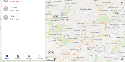
Whether it is a delivery van, a trailer in a storage yard, or a dog on a hike, Traccar is the GPS tracking server that puts it on one live map you host and control. Every position and event lands in your own SQL database. Over 200 protocols covering 2000+ tracker models decode out of the box, so a Teltonika fleet unit and a budget dongle share one device list. Pick a device to see speed, address, ignition, and total distance. Routes replay on a timeline slider, and a ruler tool measures distances. Geofences can be polygons, polylines, or circles, linked to devices or groups, colored as you like, and limited by calendar schedules. Alerts for overspeed, fuel drops, offline devices, alarms, and maintenance arrive by web, email, push, SMS, Telegram, or WhatsApp. Reports cover trips, stops, summaries, charts, events, and positions, with Excel export and scheduled email delivery. Commands go out over the tracker's own connection or by SMS, queued for offline devices. Computed attributes derive ignition or fuel values from raw inputs using expressions. Resellers get admin, manager, user, and read-only roles with device limits, plus white-label branding. Traccar Client lets a smartphone report as a tracker, and Traccar Manager monitors devices from mobile. Teams who want AI assistants to query their devices can add the MCP endpoint, which is optional. Running on a dedicated VPS on RepoCloud with guaranteed CPU, RAM, and SSD, full root SSH access, and a browser serial console. Apache-2.0 licensed.