OSRM
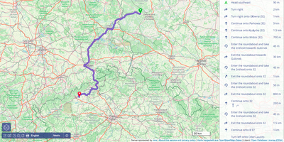
OSRM computes the fastest route between any two points, the travel time between every pair of stops, and the road a noisy GPS trace really followed, all from OpenStreetMap data on your own server. Feed it a map extract for your city or the whole planet, preprocess it with the car, bicycle, or foot profile, and the HTTP API starts answering. The route service returns turn-ready paths with distances, durations, and geometry between any coordinates. The table service computes the full duration or distance matrix between all pairs of points, which is the raw material for dispatching, territory planning, and pickup optimization. Map matching snaps noisy GPS traces onto the road network in the most plausible way, cleaning fleet and fitness data into actual driven streets. The trip service orders a set of stops into an efficient round trip, and the nearest service snaps raw coordinates to the closest road segments. A tile service exposes routing metadata as vector tiles for debugging and visualization, and a public demo frontend shows routes on a live map. Running on a dedicated VPS on RepoCloud with guaranteed CPU, RAM, and SSD, full root SSH access, and a browser serial console. BSD-2-Clause licensed.
Deploy