Reitti
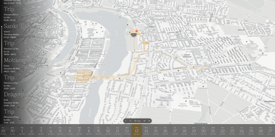
Reitti turns raw GPS coordinates from your phone and fitness trackers into an interactive daily timeline and private map that replaces Google Timeline and Life360 without sending your movement history to third-party clouds. Every coordinate you record is analyzed automatically to detect stationary visits, recognize significant places, and classify trips between walking, cycling, and driving with exact duration and distance metrics. Stream real-time updates from OwnTracks, GPSLogger, Overland, or Home Assistant, or upload historical archives from GPX files, GeoJSON, Google Takeout, and Google Timeline exports. Switching between a smartphone and a dedicated cycling computer never fragments your history. The visual workbench lets you stitch multi-device recordings across any time range, drag misplaced GPS points into position on the map, and delete signal outliers with a single click. Connect a self-hosted Immich server so geotagged photos appear directly alongside the routes and stops where you captured them. Turn memorable trips into narrative travel logs with customizable text, map, and photo blocks. Need to coordinate a meetup or share your arrival time? Share live positions with family members on the same server, federate across trusted instances, or send revocable magic links to friends without accounts. Customize your view with custom vector styles from MapTiler or Stadia Maps and explore movement statistics across top destinations. Running on a dedicated VPS on RepoCloud with guaranteed CPU, RAM, and SSD, full root SSH access, and a browser serial console. AGPL-3.0 licensed.
Open DroneLog
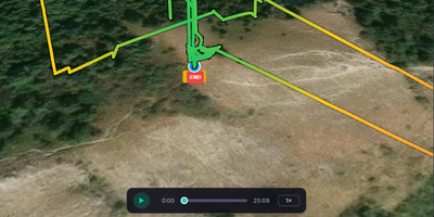
Every DJI and Litchi flight you have ever logged becomes a searchable dashboard on your own server with Open DroneLog, a free, open-source alternative to DroneLogbook, Airdata UAV, and Flight Reader. Drop in DJI .txt logs, Litchi CSV files, or Airdata CSV exports and units are detected automatically, while deduplication on drone serial, battery serial, and start time lets you re-import a folder without duplicate flights. Each flight opens as a 3D terrain map with satellite, topographic, and OpenStreetMap layers, then replays from 0.5x to 16x speed with live telemetry and an RC joystick overlay. Synchronized charts plot height, speed, battery cell voltages, attitude, RC signal, GPS, and distance to home, with drag-to-zoom. Filters narrow flights by date, drone, battery, controller, duration, altitude, distance, tag, or map area, and automatic tags such as Night Flight and Low Battery arrive with offline reverse-geocoded locations. The overview dashboard adds an activity heatmap, per-drone and per-battery charts, and a cluster map. Battery health bars track cycle counts and capacity history, and maintenance thresholds show as color-coded progress bars. Export flights as CSV, JSON, GPX, or KML, build printable HTML flight reports that save as PDF, or generate a FlyCard image for social media. A sync folder imports new logs automatically, pilot profiles can sit behind passwords, and full-database backup and restore moves data between desktop and Docker. Running on a dedicated VPS on RepoCloud with guaranteed CPU, RAM, and SSD, full root SSH access, and a browser serial console. AGPL-3.0 licensed.