OpenRouteService
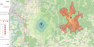
OpenRouteService gives applications driving directions, reachable-area polygons, and origin-destination travel times computed from OpenStreetMap data on hardware you control, with no metered API key. Ask for a route and it answers with turn-by-turn instructions, distance, duration, and elevation gain for cars, heavy trucks, several cycling styles, walking, hiking, and wheelchairs. Draw an isochrone and the map fills with the area reachable inside five, fifteen, or sixty minutes, ready for site selection, delivery zones, and coverage studies. The matrix endpoint prices every pairing in a grid of origins and destinations in one request, so fleet tools and location analytics stop making thousands of single calls. Steer results with avoid areas, controlled borders, tollways, ferries, and road classes, with per-request limits on distance and climb. Snap stray GPS points back onto the road network, export the underlying graph for your own network analysis, and watch instance health from the built-in status endpoints. Load the regional OpenStreetMap extract you actually serve, rebuild graphs on your schedule, and every answer stays inside your network at whatever volume your hardware allows. Running on a dedicated VPS on RepoCloud with guaranteed CPU, RAM, and SSD, full root SSH access, and a browser serial console. GPL-3.0 licensed.
Deploy