Stars
Forks
Watchers
Developer links
AirTrail
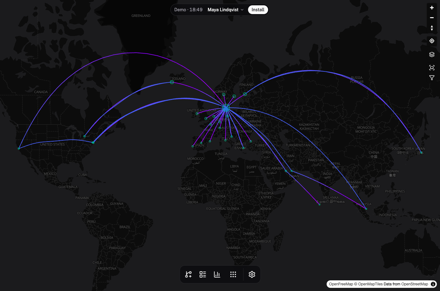
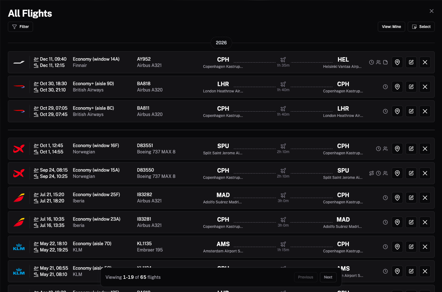
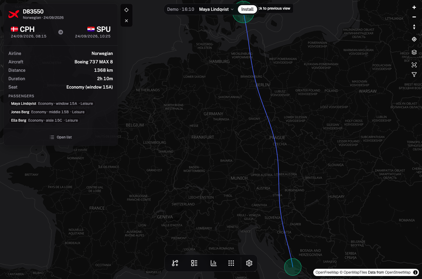
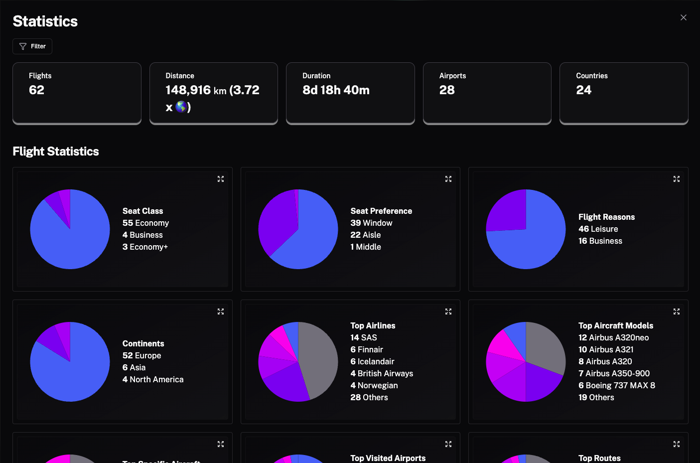
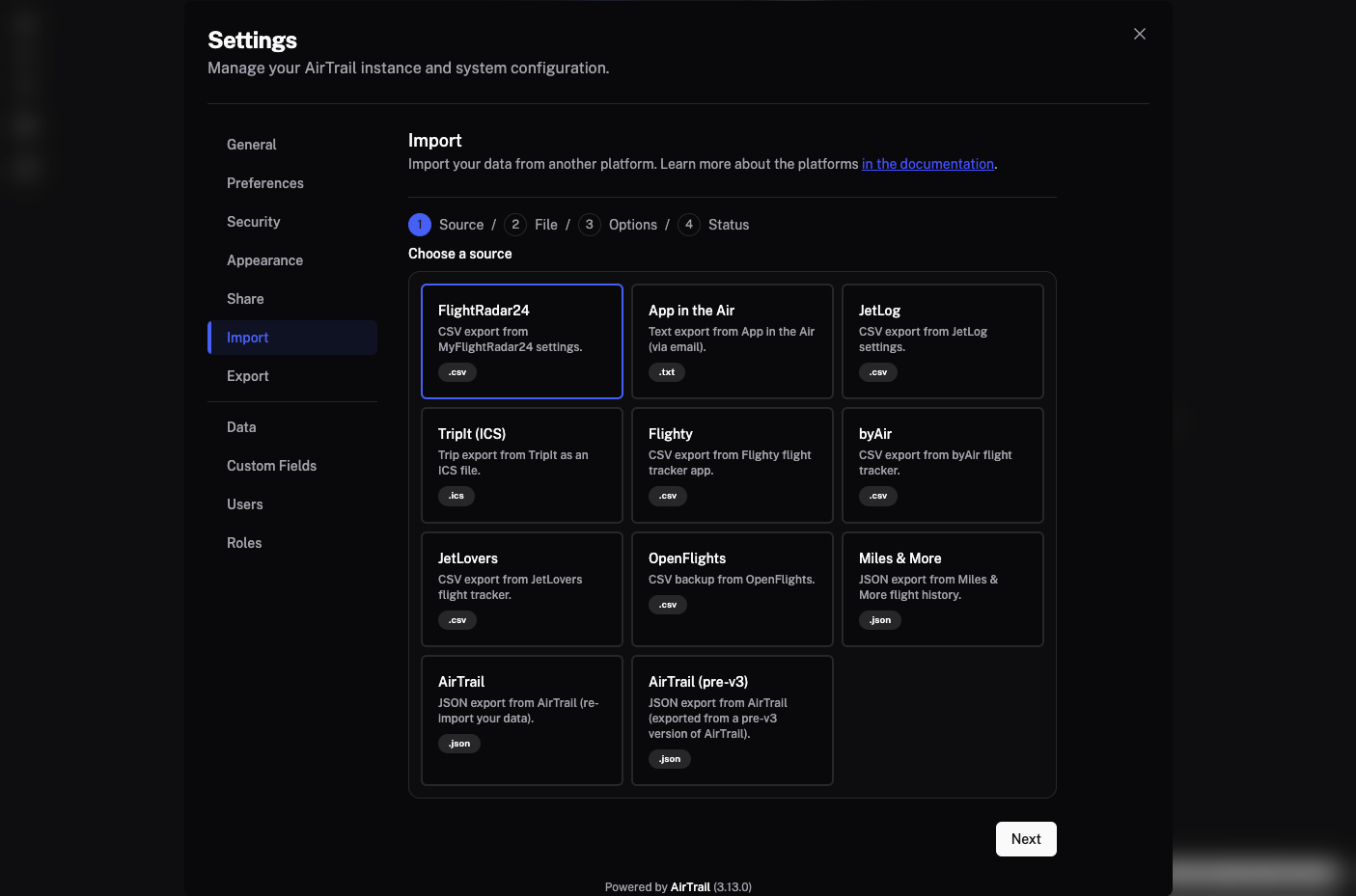
Commercial flight logbooks frequently lock historical travel records behind annual subscriptions or shut down unexpectedly, whereas AirTrail preserves your complete aviation history on an interactive world map under your own control. Enter a flight number to look up routes automatically or log departures manually with seat numbers, cabin classes, aircraft registrations, timestamps, notes, and custom metadata fields. Switching from another tracker takes seconds: the built-in importer ingests CSV, ICS, and JSON exports from MyFlightradar24, Flighty, App in the Air, OpenFlights, TripIt, JetLog, byAir, and JetLovers. The vector map renders geodesic flight paths, recorded GPS tracks, and airport runway details across customizable basemaps. Detailed statistics dashboards break down total distance flown, time in the air, top airlines, aircraft models, and visited countries. Families and travel groups can share a single instance with role-based permissions, OAuth single sign-on, and read-only public links, while developers automate entries through the versioned REST API or Model Context Protocol server. Running on a dedicated VPS on RepoCloud with guaranteed CPU, RAM, and SSD, full root SSH access, and a browser serial console. GPL-3.0 licensed.
Benefits
- Complete Ownership of Travel History
- Store every flight segment, seat assignment, tail number, and visited country in a private PostgreSQL database on your own server without relying on commercial apps that sunset services or charge subscriptions.
- Frictionless Migration from Legacy Trackers
- Import decades of historical travel data directly from MyFlightradar24, Flighty, App in the Air, OpenFlights, TripIt ICS calendars, JetLog, byAir, and JetLovers with automatic passenger mapping and duplicate detection.
- Interactive Geodesic and Track Mapping
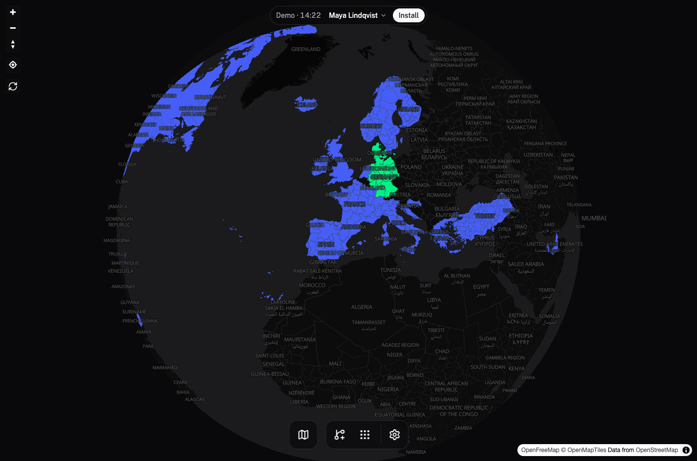
- Visualize global flight routes and recorded GPS tracks on hardware-accelerated MapLibre GL and Deck.gl vector maps featuring customizable Protomaps basemaps, airport runway overlays, and visited country choropleths.
- Multi-User Sharing and API Automation
- Host family members and travel companions on one instance with OpenID Connect authentication, shared passenger manifests, public read-only profile links, a versioned REST API, and an integrated MCP server.
Features
- MapLibre Vector World Map
- Renders flight arcs, recorded GPS tracks, and airport runway geometries using MapLibre GL, Deck.gl layers, and PMTiles vector basemaps.
- Multi-Platform Flight Importer
- Parses and deduplicates flight exports from MyFlightradar24, Flighty, App in the Air, OpenFlights, TripIt ICS, JetLog, byAir, and JetLovers.
- Travel Statistics and Choropleths
- Calculates total distance, flight duration, seat class distributions, top airlines, aircraft models, and visited countries using Natural Earth boundaries.
- Multi-User OAuth and Sharing
- Supports Lucia session management, OpenID Connect identity providers, shared multi-passenger flights, and shareable read-only public map links.
- REST API and MCP Server
- Exposes a versioned HTTP REST API and a Model Context Protocol server so external scripts and AI assistants can query or log flights.